I. Introduction
Topographic maps provide thorough and accurate representations of the topography or surface features of the Earth. They show the elevation, shape, and relief of the land, as well as water features, vegetation, and human-made structures. Understanding topographic maps is important in many fields, including geography, geology, environmental science, urban planning, and outdoor recreation. In this article, we will explore the basics of topographic maps, how to read and interpret them, their role in revealing our planet’s features and landforms, their relation to natural disasters, the differences between topographic maps and satellite imagery, and the tools and technology used to create and analyze them.
II. The Beginner’s Guide to Understanding Topographic Maps
A. Definition and basics of topographic maps
Topographic maps represent the Earth’s surface features through the use of symbols, colors, and contour lines to depict changes in elevation. They show the three-dimensional surface of the Earth on a two-dimensional map.
Topographic maps are typically based on aerial surveys conducted by planes, drones, or satellites, and are created using photogrammetry, a process that uses photographs to measure and map surface features. These images are then analyzed and transformed into a 3D digital model, which is used to create the final map.
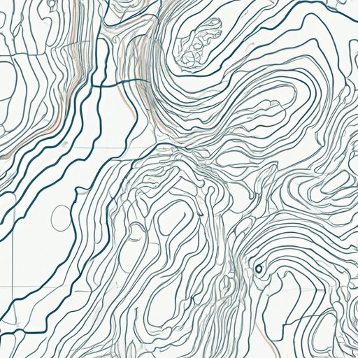
B. Understanding contour lines and elevation
Contour lines are one of the most important features of topographic maps, as they represent changes in elevation. These lines connect points of equal elevation above sea level. For example, if a contour line connects all the points on a map that are 500 meters above sea level, it is called a 500-meter contour line.
The contour interval, or the vertical distance between adjacent contour lines, varies depending on the scale of the map. Maps with large scales have smaller contour intervals, making them more detailed and accurate.
Elevation is the vertical distance of a point above or below sea level. Topographic maps use contour lines to represent different elevations, and the distance between these contour lines is called the relief. The closer the contour lines are to each other, the steeper the slope.
C. Key features on a topographic map
In addition to contour lines, topographic maps contain a wide range of symbols and colors to represent features like water bodies, forests, roads, and buildings. These features are essential for understanding the landscape and interpreting the map.
III. How to Read and Interpret Topographic Maps like a Pro
A. Understanding slope and gradient
Slope refers to the steepness of the land. It is calculated by dividing the difference in elevation between two points by the horizontal distance between them. Gradient is the rate of change in elevation over a specified distance.
Understanding slope and gradient is important for interpreting the map and determining how difficult it might be to traverse a certain area.
B. Identifying landforms and features
Topographic maps can be used to identify a variety of landforms and features, including ridges, valleys, peaks, depressions, cliffs, and waterfalls. Using contour lines and other symbols on the map, you can visualize the shape and relief of the terrain.
C. Using scale and symbols to interpret maps
To accurately interpret a topographic map, it is important to understand the scale and symbols used. The scale is the ratio of the distance on the map to the corresponding distance on the ground. For example, a 1:24,000 scale means that one inch on the map represents 24,000 inches, or 2,000 feet, on the ground.
Symbols on topographic maps represent different features on the landscape. For example, a blue line represents a stream or river, while a brown line indicates a contour line. Knowing what each symbol represents is essential for understanding the map.
IV. What Topographic Maps Reveal About Our Planet’s Features and Landscapes
A. How topography influences land features
The topography of an area plays a crucial role in shaping its land features. Mountains, valleys, rivers, and lakes are all formed by the natural processes that shape the Earth’s surface. Topographic maps allow us to visualize these features and understand the natural processes that created them.
B. Examples of notable topographic features
Topographic maps can reveal a variety of notable features, including the highest and lowest points on the Earth’s surface, the extent of glacial ice, and the location of geological faults and tectonic plates. For example, Mount Everest, the highest point on Earth, is located in the Himalayan range, which is visible on topographic maps.
C. Importance of topography in understanding our planet
Topographic maps are essential for understanding our planet’s geography and geology. They help us visualize the complex interplay between the Earth’s natural systems and human activities. Topography is also critical for predicting and responding to natural disasters, managing natural resources, and protecting biodiversity.
V. The Role of Topography in Natural Disasters: A Look at the Nepal Earthquake
A. Explanation of how topography can trigger natural disasters
Topography can play a significant role in triggering natural disasters like earthquakes, landslides, and floods. For example, areas with steep slopes are more prone to landslides, while regions near plate boundaries or fault lines are more likely to experience earthquakes.
B. Analysis of the Nepal Earthquake and its relation to topography
The Nepal earthquake of 2015, which killed over 9,000 people and injured over 22,000, was triggered by the collision of two tectonic plates beneath the Himalayan range. The area’s topography, including its steep slopes and vulnerable buildings, contributed to the severity of the earthquake and its aftershocks.
C. Importance of understanding topography in natural disaster preparedness
Understanding topography is crucial for preparing for and responding to natural disasters. Topographic maps can help identify areas at risk for disasters like landslides, floods, and earthquakes. This information can be used to plan evacuation routes, construct stable buildings, and establish emergency response measures.
VI. Topographic Maps vs. Satellite Imagery: Understanding the Differences and Similarities
A. Explanation of the differences between topographic maps and satellite imagery
Topographic maps and satellite imagery are two primary tools for understanding the Earth’s surface. While both provide valuable information, they have distinct differences. Topographic maps represent elevation, while satellite imagery shows the Earth’s surface features and appearance.
B. Advantages and disadvantages of using each for different purposes
Topographic maps are typically more accurate and detailed than satellite imagery when it comes to representing elevation. However, satellite imagery is useful for understanding aspects like land cover, vegetation, and weather patterns.
C. When to use topographic maps vs. satellite imagery
The ideal tool for a particular project or activity depends on what information is needed. If you are interested in elevation and slope, a topographic map is a better choice. If you want to visualize the surface features of an area, such as roads, buildings, and vegetation, satellite imagery is more appropriate.
VII. Topographic Mapping Tools: Which One is Right for Your DIY Mapping Projects?
A. Overview of different topographic mapping tools available
There are several mapping tools available for creating digital and paper topographic maps, including Geographic Information Systems (GIS), drones, smartphone apps, and computer software.
B. Analysis of the benefits and limitations of each tool
Each mapping tool has its own unique benefits and limitations. For example, GIS software is useful for creating comprehensive and detailed maps, but it can be expensive and complex to use. Drones are useful for capturing high-resolution aerial imagery, but they require specialized knowledge and training.
C. Choosing the right tool for your specific DIY mapping project
When selecting a tool for a DIY mapping project, it is important to consider factors like the scale of the project, the level of accuracy required, and the available resources. In some cases, a low-tech tool like a paper map and compass may be sufficient, while in others, a more advanced tool like GIS software may be necessary.
VIII. The Intersection of Technology and Topography: How GIS is Revolutionizing Topographic Mapping
A. Explanation of Geographic Information Systems (GIS) and how it is used in topography
GIS is a computer-based system for capturing, storing, analyzing, and managing geographic data. It is commonly used in topographic mapping to create detailed digital models of the Earth’s surface.
B. Examples of how GIS is revolutionizing topographic mapping
GIS technology is transforming topographic mapping in numerous ways, including making maps more accurate, detailed, and accessible. GIS software allows for the seamless integration of diverse datasets, such as aerial imagery, topographic maps, and weather data, which can aid in disaster response and management. GIS also allows for the creation of 3D models that can be used for urban planning, development, and conservation.
C. Future possibilities of technology for topographic mapping
As technology continues to advance, new tools and techniques for topographic mapping are emerging. For example, LiDAR (Light Detection and Ranging) technology uses lasers to create highly detailed 3D maps of the Earth’s surface. This technology has important applications in fields like land conservation, forestry, and transportation planning.
IX. Conclusion
A. Recap of the importance of understanding topographic maps
Topographic maps provide valuable insights into the Earth’s surface features and are essential in many fields, including geography, geology, environmental science, and outdoor recreation. Understanding topographic maps is important for interpreting the landscape, identifying potential hazards, and planning for sustainable land use.
B. Final thoughts and advice for readers
Whether you are an outdoor enthusiast, a scientist, or a developer, topographic maps can provide a wealth of information about the Earth’s surface and its processes. To get started with topographic mapping, it is essential to understand the basics, choose the right tools, and practice interpreting maps.
C. Call to action for readers to start utilizing topographic maps in their projects or activities
By utilizing topographic maps in your projects or activities, you can gain a deeper understanding of the natural processes that shape our planet and contribute to sustainable land use. Whether you are planning a hike, studying geology, or developing a new neighborhood, topographic maps can provide the crucial information you need to succeed.